With heavy storms in the forecast, I stayed another day at Nia’s. Working on my phone during the day, a trip to a supermarket and playing games that evening.
I spent a lot of the day looking at the next day’s travel. About 40 km south of Richmond (just south of Petersburg) were two campgrounds along I-85. If I chose to follow I-95 I could camp at a campground about the 100 km point, but some math showed I would be no closer to home for that additional 60 km of cycling! Along I-85 I couldn’t find anything at around the 100 km point except an expensive AirBnB. The next accommodation wasn’t until South Hill, some 160 km from where I’d start the day.
In the end I just decided to wing it. I’d head south along I-85. If I decided to stop early, I could camp. If I reached 100 km, I had the AirBnB (presuming it hadn’t been rented) as an option. I also anticipated several small motels along the way. And some miracle might come along and I’d end up in South Hill. You never know.
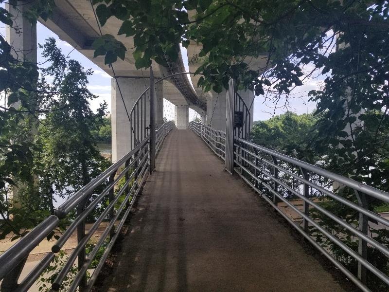
Starting the day just north of Richmond, I spent forever getting through Richmond. Roads under construction, and a twisty, winding path of the ECG. It would have been far faster to just head south and re-correct on the other side. Part of the navigation woes came from arriving at the crossing for the James River. A suspension pedestrian bridge hung directly below the highway.

Petersburg was faster, but another delay. My hourly average meant if I wanted to go 160 km, I’d arrive well after dark. I continued south. As I rode my hourly average improved, but not enough. However, arriving at 100 km and looking only at my most recent hour, I’d likely roll into South Hill just before dark. And there was always the possibility of finding a small motel along the way. Onwards.
I don’t like leaving that little margin for error, but there’s a reason I’m prepared for wild camping as well. I did pass a small motel, shuttered as an obvious victim of traffic diverted from Highway 1 to I-85.
I had anticipated, with I-85 nearby, that traffic on Highway 1 would be manageable. When I had looked at the route, the ECG occasionally merged with Highway 1, so it’d be OK, right? No. Heavy traffic on Highway 1 made cycling … unpleasant. I could manage the four-lane (as cars would pass in the right lane). I usually cycle as close to the margin as possible, but in the two-land highway that meant drivers felt they could pass without crossing the double-yellow lines, which did NOT leave enough room. For the two-lane I continued to use the trick of cycling with 100% of my bicycle in the road. Drivers then would change entirely to the other side of the road to pass (making for the occasional exciting moment for incoming traffic).
The ECG does a good job of selecting routes that are moderately level. But it also regularly routed me onto heavy traffic highways. Not a fan.
The only bright side of major highway was a faster pace, and I arrived in South Hill not long before dark, encrusted in salt. 158 km.

With the extended day, that placed Durham and home only 160 km away. I left the hotel an hour earlier than I’d left the day before and, with no major cities in my way, made it home around 7:00 pm, with a total for the day of 164 km, the next to last 15 km riding in heavy traffic.

